Mt Kenya National Park
Mt. Kenya is an imposing extinct volcano dominating the landscape of the Kenyan Highlands, East of the Rift. Mt. Kenya lies about 140 km North, North-East of Nairobi with its […]
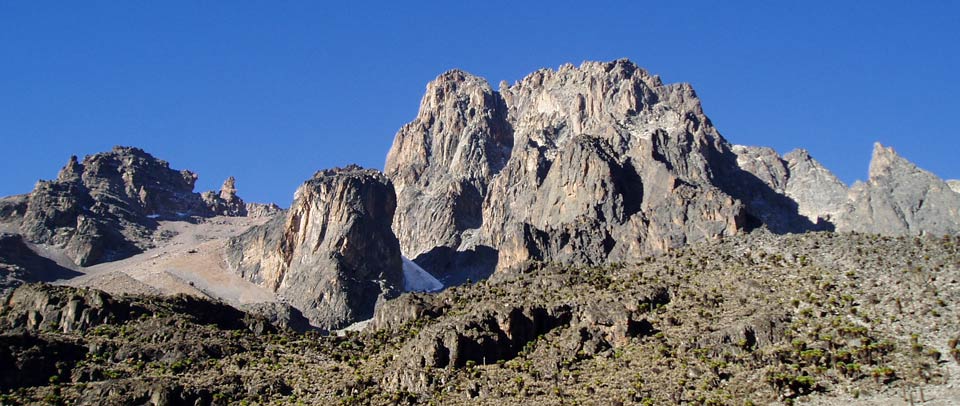
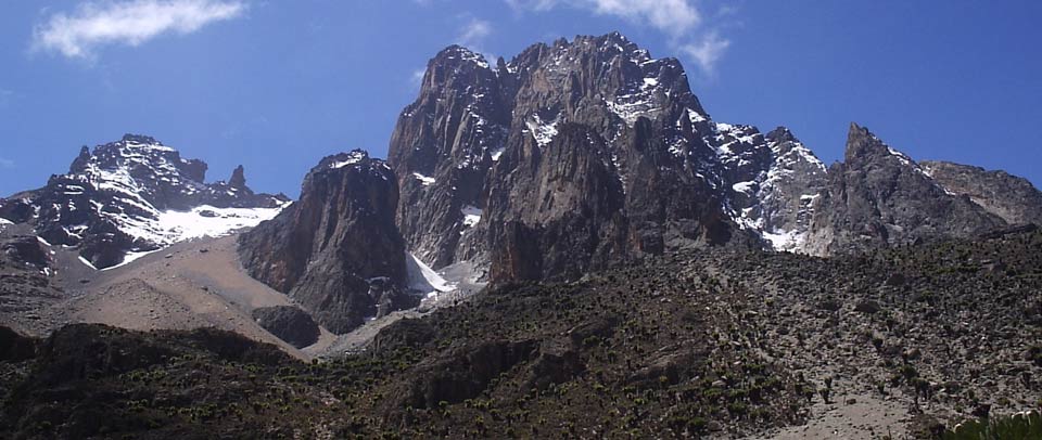
Mt. Kenya is an imposing extinct volcano dominating the landscape of the Kenyan Highlands, East of the Rift. Mt. Kenya lies about 140 km North, North-East of Nairobi with its Northern flanks across the Equator. The mountain has two main peaks – Batian (5200m) and Nelion (5188m). The mountains slopes are cloaked in Mount Kenya seen through foliage and a cloudy skyforest, bamboo, scrub and moorland giving way on the high central peaks to rock, ice and snow. Mt. Kenya is an important water catchment area, supplying the Tana and Northern Ewaso Nyiro systems.
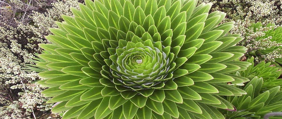
The park includes a variety of habitats ranging from higher forest, bamboo, alpine moorlands, glaciers, tarns and glacial morains.The park was inscribed by UNESCO as a World Heritage Site in 1997 and is also a Biosphere Reserve. Major attractions include: Pristine wilderness, lakes, tarns, glaciers and peaks of great beauty, geological variety, forest, mineral springs, rare and endangered species of animals, High altitude adapted plains game, Unique montane and alpine vegetation with 11 species of endemic plants.
Key features
Wildlife
- Include Elephants, tree hyrax, white tailed mongoose, suni, black fronted duiker, mole rat, bushbucks, water buck and Elands. Animals rarely seen include leopard, bongo, giant forest hog .
Birds
- Over 130 bird species have been recorded.
Important Information for Visitors
- All visitors should enter the park with a qualified and certified guide. Guides and potters have identification cards issued by the park management.
- Disposable plastic water bottles are not allowed in the park.
- Guides and potters are not allowed to carry luggage that exceed 25KG. Weighing of luggage will be done at the gate on entry.
- All visitors are required to check in and out of the park, this is done by recording personal information in the entry and exit books.
The Aberdares National Park
The Aberdares are an isolated volcanic range that forms the eastern wall of the rift valley, running roughly 100km north south between Nairobi and Thomsons Falls.
Soils are red and of volcanic origin, but rich in organic matter. There are two main peaks, Ol Donyo Lesatima (3,999m) and Kinangop (3,906m) separated by a long saddle of alpine moorland at over 3,000m. The topography is diverse with deep ravines that cut through the forested eastern and western slopes and there are many clear streams and waterfalls. The Aberdares are an important water catchment area providing water to the Tana and Athi rivers and part of Central Rift and Northern drainage basins. The National Park lies mainly above the tree line running along the 10,000ft contour with some forest and scrub at lower altitude in the ‘salient’ area near Nyeri with the boundary running down to the 7000ft contour. The unusual vegetation, rugged terrain, streams and waterfalls combine to create an area of great scenic beauty in the National Park. The park is surrounded by a predominantly indigenous forest.
Major attractions are; Lesatima peak, Kinangop peak, waterfalls, walks in the moorlands, Twin hills, Elephant hills and Table mountains, Elephants, Second largest population of black rhinos in Salient and Northern Aberdares, Queen Elizabeth learned of her accession to the throne at Tree-tops, The Kimathi Hideout, Night viewing of wildlife at the Ark & Treetops.


